Saturday, 28 January 2012

The Calne Town Trail via the Wilts & Berks Canal and the old Railwayline.

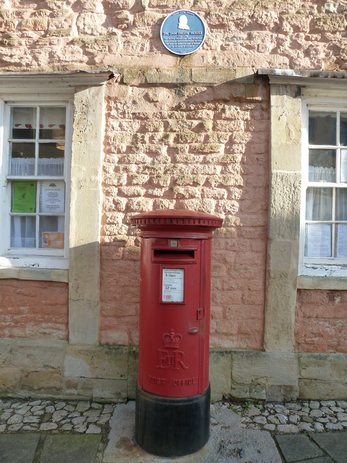
Red ER pillarbox and Blue Plaque
Yesterday we recced the outskirts of Calne and the Town Trail, an interesting walk around the little town situated about six miles from Devizes.  The main A4 Bath Road runs through the town centre, but if you walk the side streets, a whole new world of interesting buildings and history opens up to be explored.  The photo left shows two iconic symbols of Englishness, a red pillarbox and a blue plaque.  All pillarboxes have the  royal crest and initials of the incumbant monarch imprinted at the time of casting. The Blue Plaque scheme recognises places where famous people have lived, worked  or died.  This one commemorates Dr Jan Ingenhousz who, with others, discovered photosynthesis.  Further along the street is the house where Dr Joseph Priestly, the discoverer of Oxygen in 1774, lived and worked.  A blue plaque here commemorates his work.

Below, the recently restored "Chaveywell Bridge" spans the Calne Arm of the Wilts & Berks canal.  The main line of the W&B canal connected the Kennet & Avon canal with the River Thames at Abingdon, but is long abandoned and infilled.  Sections have been restored,  and it is hoped that one day it will be open again to boats, with Swindon, once again, having  a  the canal running through the city.  Many canals throughout England are being restored, as people realise their potential for leisure activities, including: boating, fishing, jogging, walking, birdwatching and industrial history studies.
The newly restored "Chaveywell Bridge" spans the Calne Arm of the Wilts and Berks Canal.

The path towards the distant derelict canal and railwayline.
The railway once ran through Calne connecting it to Bristol and Bath in the west and Reading in the east.  The line was abandoned in 1960, when many lines in Britain were axed to save money, a decision now regarded as a somewhat shortsighted.  However the defunct line has become an easy, level walk which connects Calne with nearby Chippenham.  We walked part yesterday, and discovered some relics of the old railway line, pieces of metal fencing and the top of a telegraph pole.  The line of the old canal is still visible, with one section restored and in water, and an old lock being renovated as a visitor attraction.
The soft coloured houses in a Calne backstreet. 

Thursday, 26 January 2012

Preparing Two Talks for the DEG in Braunschweig.

Leaflet for the Town Walking Trail
The Avebury information leaflet, giving inside a detailed map of the area.
The city of Braunschweig has a thriving English German Association and each month they hold a meeting with a guest speaker, who gives an interesting talk in English about some aspect of life in GB.  I talked to the group last year about the Kennet and Avon Canal, and this year I will give two talks, one about  "My Life in Devizes" and the other about "Avebury, a Prehistoric Landscape."   I've gathered together some leaflets on which I will base my talks, and will enhance them with my photographs and anecdotes. 

The Medieval Town Trail in Devizes is marked with thirteen wall plaques, each giving information about the particular spot at which it is placed.  The one below marks the spot in Couch Lane where,  in medieval times,  the edge of town  met open farmland.  Devizes has an interesting and turbulent history, royalty once lived in the castle and a famous Civil War battle was fought on Roundway Down.  In the middle ages it was a prosperous town,  and when the canal opened in 1810, it bought new opportunities for trade.  Many Devizes civic buildings date from this time, when Bath stone arrived by barge for the construction of the fine Town Hall, Corn Exchange, and other buildings.
Plaque No.12 giving information about Couch Lane, which was once on the very edge of the town, where it met farmland.  Most people in medievel times spent their entire lives working on the land.  They lived hard lives, infants died young, and life expectancy for the poor was about 40 years of age, although the wealthy could expect to live into old age. 

Wednesday, 25 January 2012

To "The Firs" then up and over Easton Down to the "Bridge Inn" at Horton.

"Strip Lynchets" on Easton Down
This morning's walk up and over Easton Downs took us past these "Strip Lynchet" the remains of a Celtic farming system of flat ridges ploughed into the side of a hill, making a sloping surface workable for the growing of crops.   The walk of just under five miles was a recce, (short for reconnaissance) a walk into the unknown, needing to be "recced" in the hope of finding the right path, thus avoiding the walking group becoming lost!

This part of Wiltshire is famous for its many barrows, ancient burial sites made by prehistoric man.   The county has 80% of the entire chalk grassland in Britain, and to cultivate so much undulating land, early man needed ingenuity, thus the "Lynchets" formed in the hillsides.   Silbury Hill, that strange man made mound reaching up to the sky is just out of shot in the photo below.   Know one knows why it was built, and a lot of man hours went into its construction, which could have been spent on growing food.   We may never know the real answer of why it was built.  Below's view shows the rolling landscape nature of beautiful Wiltshire.
Looking towards the Marlborough Downs

The "Wansdyke" defensive ditch.
"Wansdyke" consists of two sections, 9 and 12 miles long with some gaps in between. East Wansdyke, the part that runs across this landscape is an impressive linear earthwork, consisting of a ditch and bank running approximately east-west, between Savenake Forest and Morgan's Hill.  Here the bank is up to 13 ft high with a ditch up to 8.2 ft deep. 

Wansdyke's origins are unclear, but archaeological data shows that the eastern part was probably built during the 5th or 6th century.  After the withdrawal of the Romans and before the takeover by Anglo Saxons, the ditch on the north side, was presumably used by the British as a defence against West Saxons encroaching from the upper Thames Valley,  westward into what is now the West Country.

Saturday, 21 January 2012

Civil War Cannonball holes in the tower of St James's Church, and some Geese.

Canada geese and gulls on a windy "Crammer" pond.
The canada geese and gulls seem to like the "Crammer" pond, where they receive daily a goodly amount of food and never want to fly off home.  St James's Church can be seen in the background of the photo, with its graveyard and the new wall at the water's edge.  The old wall collapsed into the pond two years ago, and a big tussle ensued as to who was to pay for a new wall.  I think the church and the local council eventually came to some arrangement.  This church is one of three large medieval churches in Devizes, and very unusual for a small town.  The following website:  www.devizesheritage.org.uk  is worth reading, as it gives more information about this church.  Type St James's Church in the search box.   It has been very mild here of late, and in the graveyard,  little clumps of snowdrops are beginning to show their tiny white heads.
St James's Church on a dark and windy Saturday morning.
This photo makes the morning appear far darker than it was, and reminds me of the church and graveyard in Haworth in Yorkshire, where the famous Bronte sisters lived and wrote their novels.  I was so immersed in taking these photos, that when the clock suddenly struck 12 noon, it frightened me to death!
The tower showing two canonball holes.
If you look carefully at the tower you can see two black holes in the stonework.  These are canonball holes made by guns firing at the church from Coatefield up on the old Jump Farm.  During the English civil war a battle took place on Roundway Down in Devizes on July 13th 1643.  The day before, the Royalist became trapped by the Roundheads, who besieged the town with canon and guns.   The Royalist Prince Rupert managed to escape and rode to Oxford for reinforcements, who returned to Devizes and met the Roundheads up on the Down, where a bloody battle ensued.  The Royalists won, having driven some of the Roundhead horsemen over and into "Bloody Ditch."   Very nasty!  

On the battlefield site platforms have been erected which give an elevated view of the whole scene.  Information boards provide details of the battle at each particular position, and you can almost hear the sound of the horses and screaming soldiers and the smell of death and blood!   Not a place to visit in the dead of night.
A closeup, showing more detail of the canonball holes.  The Roundheads mounted their canon on a hill overlooking the town and  fired shots at the church where the Royalist had taken refuge.  In the mid 19th century two canonballs were discovered in the bell tower,  and these are now displayed in  Devizes Museum.  Few relics of the battle have been found.  I assume the bodies were stripped of valuables, so no trace was left, and the body of only one soldier is buried in Bromham Churchyard.

Thursday, 19 January 2012

The Weather is Terrible, therefore it must be Thursday and Market Day.

Pots of Hyacinth and primulas
Every Thursday the weather in Devizes is absolutely terrible!  Sometimes the market traders don't bother to erect their canopies and awnings and why?   They get blown down in the high winds as soon as they are put up.  Today it poured with rain for a couple of hours, although by 10am it had brightened up and the sun shone for a good 30 seconds!   I like taking photos in the market, as there is much opportunity to see the decorative side of flowers, fruit and veg.  On occasions I get quizzical looks from the stall holders, who simply cannot see the beauty in big green cabbages, bundles of carrots and bunches of bananas and grapes.
Tubs of heather, snowdrops and white primula.
Spring flowers are rearing their little heads, and because of the unseasonally warm weather, some are far too advanced and will end up with frosted buds if they are not careful.  The snowdrops and heathers are very hardy, and the primulas can stay indoors.
Pink, hardy cyclamen await a buyer.

Tuesday, 17 January 2012

Canalware and Gifts for Sale in the Wharf Shop, Devizes


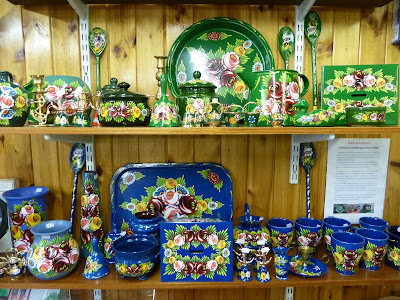
Traditionally painted canalware for sale.
The Wharf shop had been looking a bit tatty of late, so after a revamp last week when walls were painted, doors repaired, furniture moved about, the ice cream freezer and the drinks cabinet repositioned  and the counter smartened up, I was invited to take some photos that will eventually go into the "Butty," the bi-monthly magazine of the "Kennet and Avon Canal Trust." 

The pottery above is traditionally painted canal ware, showing roses and leaves.  The old bargees painted their barges, buckets, tillers, doors, hatches and brooms with decorative patterns of roses and castles.  The origin of this kind of decoration is unknown, but modern boaters still decorate their boats in this way

Models of the old barges, workboats and narrowboats.
Model boats for sale, the upper ones replicas of the old working barges that carried goods from Bristol to London, stopping on the way to deliver coal, flour, wood, stone and a multitude of all the necessitites of life to the towns situated on the canal.
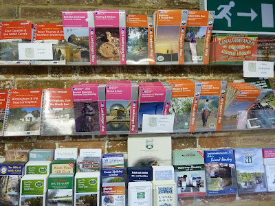
A selection of canal guides and maps of the local area.
It is useful to have a canal guide, just like a road map it gives you details of canal mileage, the lock widths, the bridges, mooring places to stop for the night,  and best of all, information about where you can buy your next plate of fish and chips.   Devizes has three really good chippies, the one in the Market Place is the best!
Children´s toys for sale. 
During the summer months many visitors come to Devizes from around the world to visit the canal and the shop.  Parties of school children also come to learn about the history of the canal as part of their history lessons.  Here they have a chance to spend their precious pennies on souveniers in the shop.


Monday, 16 January 2012

Sheep, Saxon Church, a Lock, a Lock Up and a Tithe Barn in Bradford on Avon

Sheep grazing beside the River Avon.
I'm beginning to think that I should have called this blog, "Devizes Walking Days" as just recently I can't stop writing about walking!  I did 17 miles last week and have started the new week with another 4 miles.  Today's walk began near the town lock and we walked along the towpath to Widbrook Wood and down to the River Avon.  This  scene of English tranquility could have been  painted by John Constable, with the river, a flock of sheep, trees and sunshine, (no rain.)  What a beautiful afternoon for a walk. 

The Kennet and Avon canal passes through Bradford (a corruption of: broad ford) and where John Rennie the canal engineer used the river to supply water to the canal.  The town is also the site of the "Avoncliff Aqueduct" a magnificent structure, built to carry the canal over the river.       www.avoncliff.co.uk
The medieaval Town Bridge complete with a "Lock Up."
The old town "Lock Up" was a place to imprison troublemakers overnight.  It is not very big, and I assume only one person at a time was locked up, or did they cram a dozen or so in when the partying got out of hand!  I am glad "Human rights" have moved on a bit!  The bridge still carries the main road over the river.  It is much too small for today's traffic, and causes permanent traffic jams in the town.   www.bradfordonavon.co.uk
St Laurence Saxon Church founded by St Aldhelm in ca. 705.  For many years it was surrounded by other old buildings, and when these were demolished in the mid 19th century, the little church was rediscovered.  It had been part of somebody's house in medieaval times.

Bradford on Avon Lock on the Kennet & Avon Canal.
This lock takes the canal down towards Bath.  This area has interesting connections with the last century, when the canals were hives of industry, carrying goods from Bristol to London and needing places to unload goods, wharfage, stabling for the horses, and inns for the boatmen to drink and be merry.   The barges were family concerns, and would carry an entire family, mum, dad and many children.  On the right of the photo is the site of a dry dock, still used today to repair the boats, and left can be seen an old canal building, maybe the home of the old lock keeper and his family.
The medieaval Tithe Barn at Barton Farm, is in what was a manorial estate, complete with farmhouses, chapel and sheds for animals.  The barn is huge, 180ft long and 30ft wide and is now a Grade 11 listed building.